Avi Rana
GIS Portfolio
Lab 2 began in ArcCatalog by creating Geodatabase and Feature Dataset. Then ArcMap was used to conduct a spatial analysis of the impact that severe flooding in Pierce County might have on the public transportation infrastructure. This analysis required working with 'dissolve' and 'intersect' tools as well as using the attribute tables. All the data used for this was available from GIS 312 class.
Lab 2
Transit Routes in Flood Zone
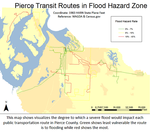
The goal of this lab was to produce a map that visualizes the degree to which a severe flood would impact each public transportation route in Pierce County.
ArcGIS Tools + Methods
-
Created Geodatabase & Feature Dataset.
-
Dissolve was used to combine all of the individual line segments of public transportation route.
-
Intersect was used on the line segment with the flood hazard zones to determine the percent of each line that is located in a hazard zone.
-
Dissolve was used again to determine the percent of each route that would be compromised in a severe flood.
-
Final task was to join the attribute table to allow symbolization of each complete transit route using a color gradient to designate how vulnerable the route is to flooding

